Grand Teton and Yellowstone National Parks
Saturday, June 23: Driving around Yellowstone
After two days of dawn-to-dusk activity, you’d think we’ might have slept in this morning. Some of us might have, but overall we were up and out and about early again. Reloaded up in the overly-familiar SUV and headed out for the day, beginning with a short ride along a new-to-us portion of the main roads in the park. Our primary goal for the day was the northeast quadrant of the part, where Dan had marked our map as a point where we could expect to see both bison and antelope. Antelope would be a new treat for us, and we thought that might be the big event of the day.
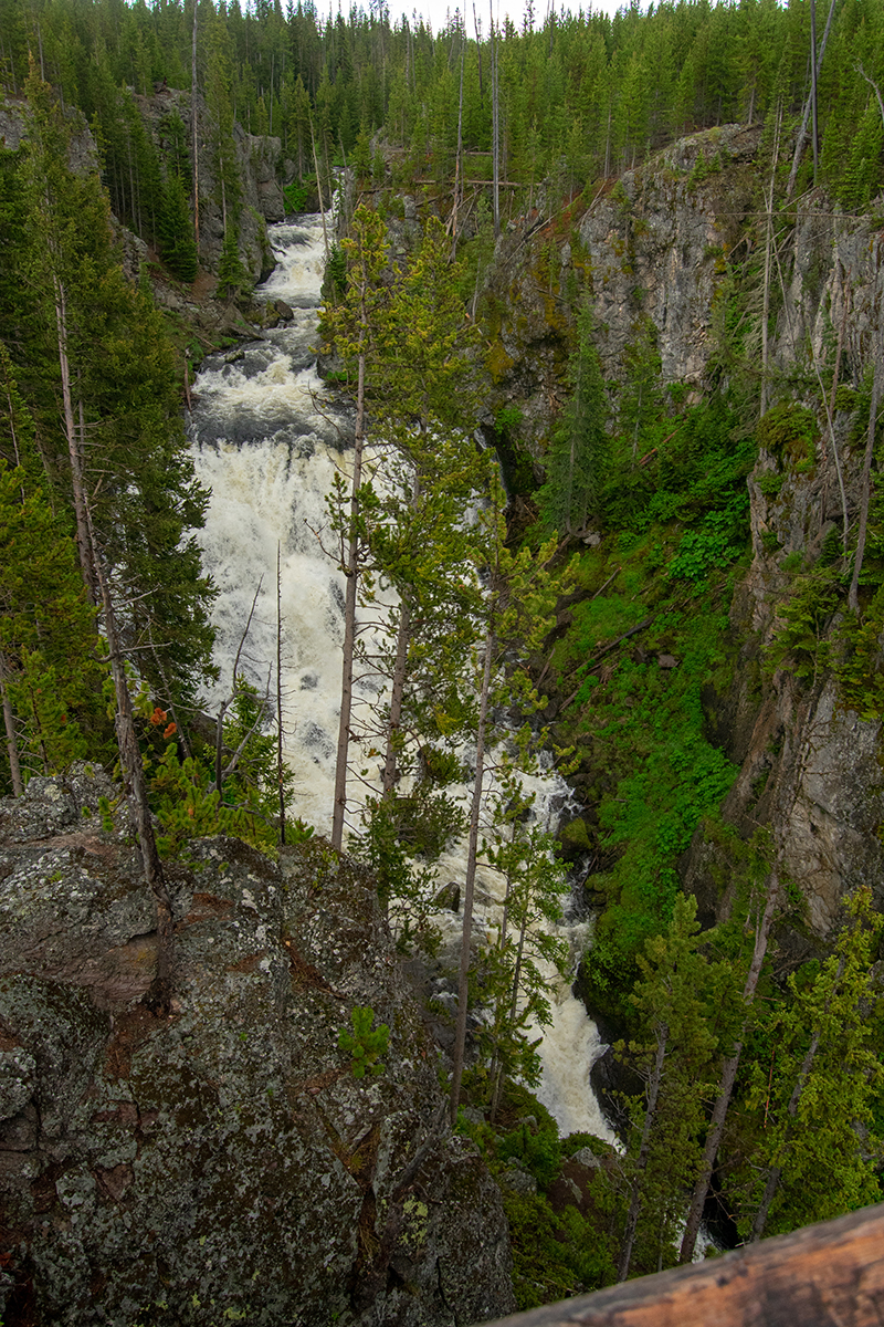
 We loaded up, drove off, made one false turn, started out again, and still made our first stop only 20 minutes after we got in the car. That stop was prompted this time by a simple point on the map, not just one Dan had recommended. We stopped and followed a walkway over the Firehole River so we could grab a quick look at the Kepler Cascades. We got a good look at a series of falling rapids. That might not make sense, but that’s what we saw: a river going downhill really fast, making all sorts of rapids Not free-falling like a waterfall, not so steep as a waterfall, but steeper than what we thought of as the usual rapids a guide would take tourists through on a raft.
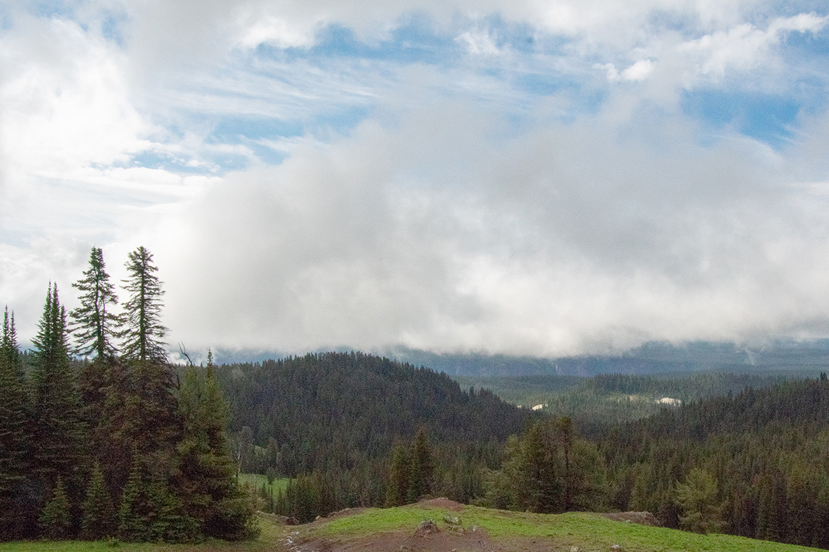
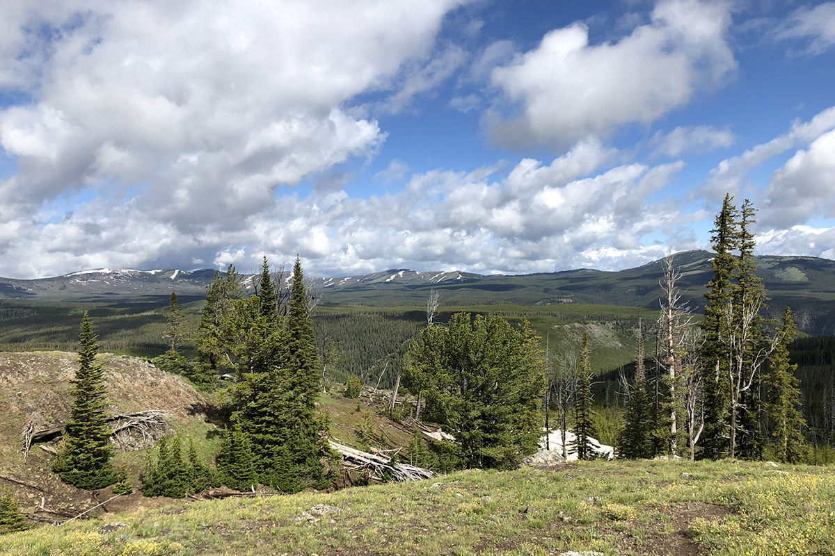
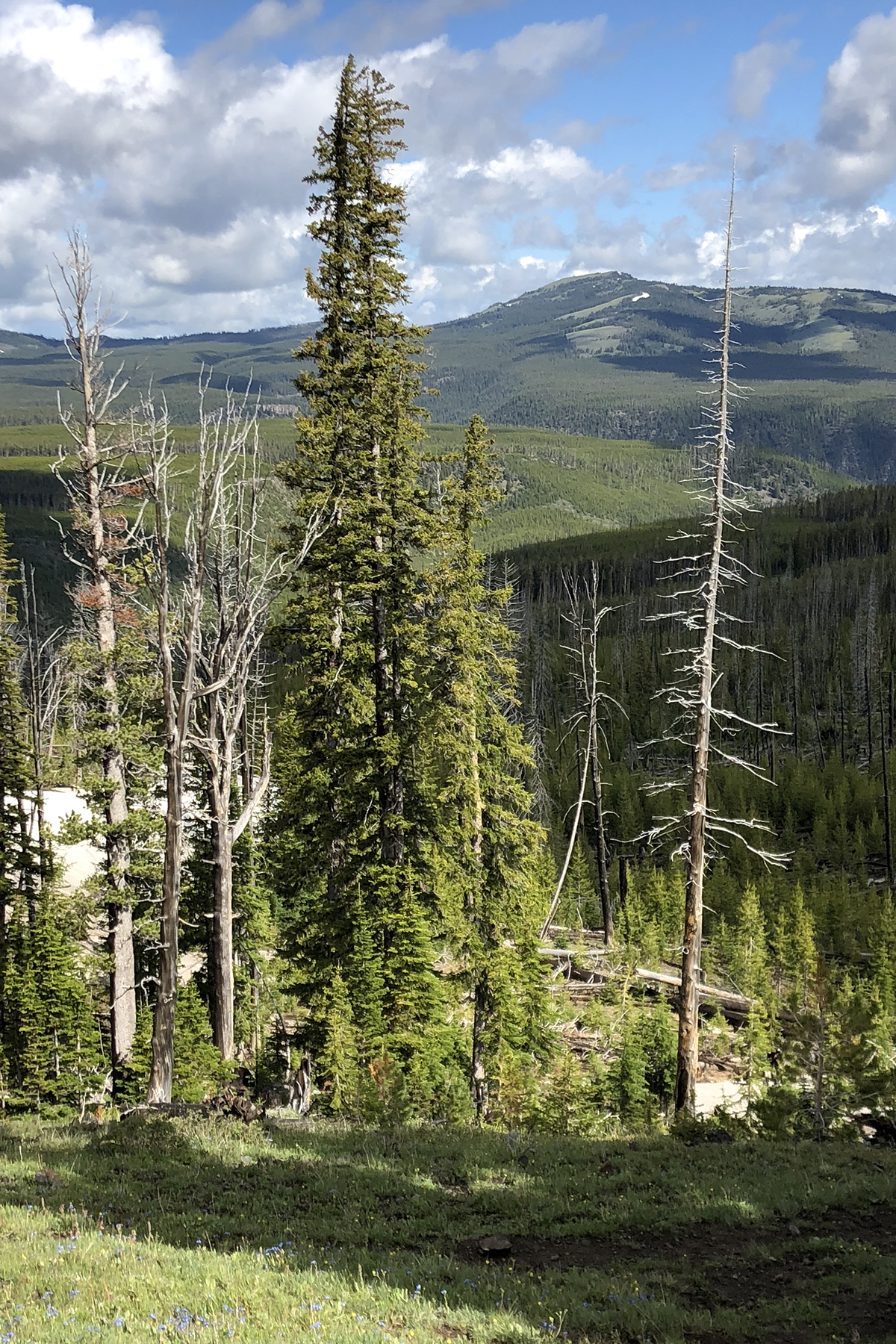
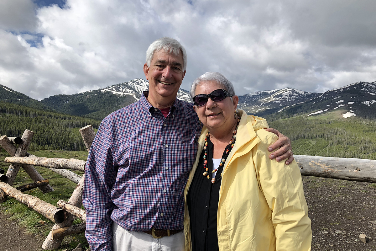 Soon enough we were back on the road we had travelled the day before, a big boost to our comfort level. We stopped for the usual reasons a couple of times, needing food, gas, and restrooms, and managed to make a couple of purchases at each stop. This time, when we passed Canyon Village we kept going north, and to use Judy’s phrase, we all noticed a “vast change in the vegetation.” Not to mention the steep incline of the road we were on. To hear us talk, we could have been in a reality show called “Flatlanders Visit the Rockies.” At one point, probably close to the highest point we would reach, we couldn’t resist and parked in a convenient pull-out just to look around. I don’t remember driving through any more beautiful countryside in the Alps. And to be honest, I’ll probably never get used to seeing snow on mountains in the middle of summer. It just makes my inner child smile.
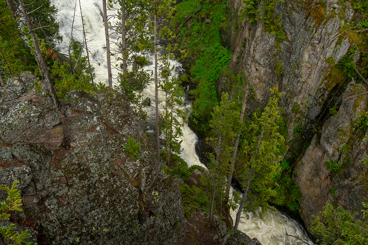
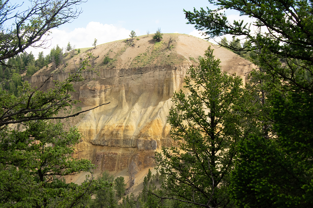 We made a couple of stops before we reached the area where we might expect to see some antelope. This time the attraction was Tower Fall, although we enjoyed the sight of the canyon as much as we did the falling water. This area is also on the Yellowstone River, just miles north of our stops the day before. We saw a lot of the same types of rock here, especially the yellowish stone that gives the place its name. The opposite side could have been used in a geology class to talk about sedimentary rocks and geological layers. Then again, that could just be the teacher gene speaking, It was cool to look at either way.
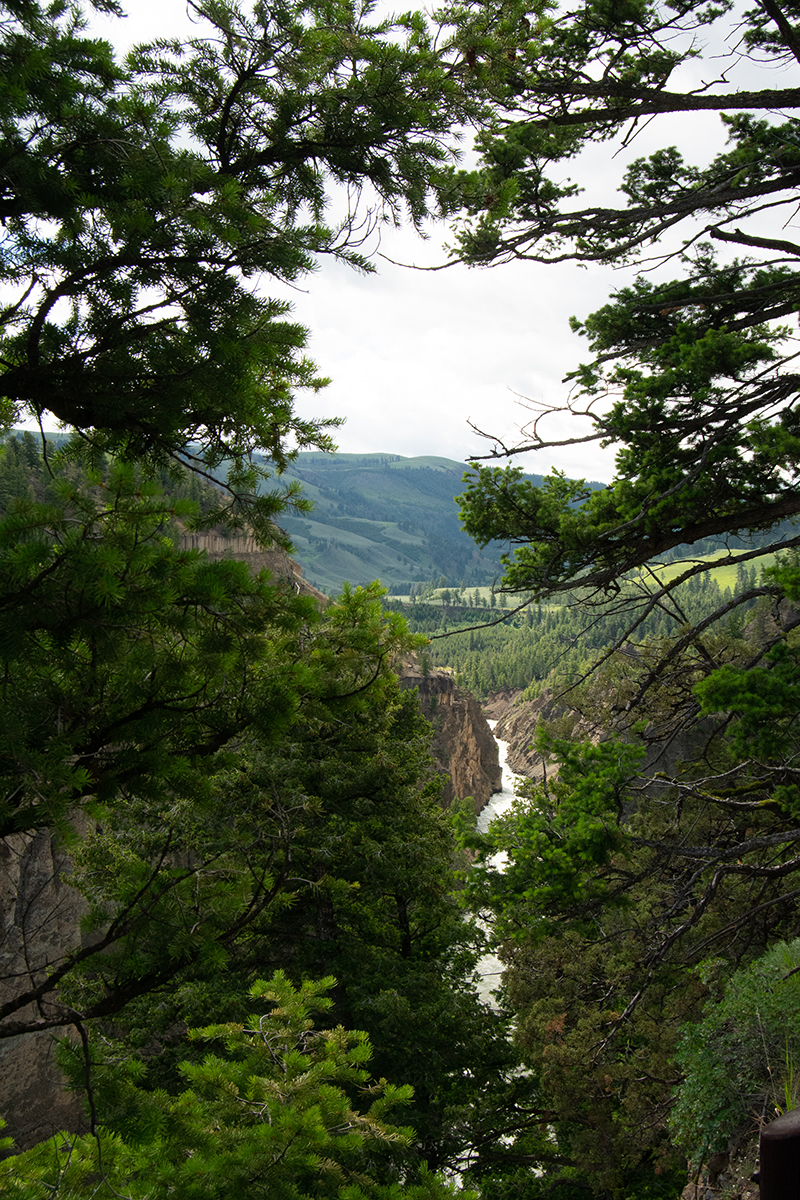
 Although that particular stop (Tower Fall) had what we were beginning to recognize as the ubiquitous shopping and dining opportunities, and lots of other tourists, the same wasn’t true of our next stop: Calcite Springs Overlook. We were the only people around, but what we saw was beginning to change. We’d basically been following the Yellowstone River north, although our path bowed west while the river bowed to the east. Here we were at the end of the canyon, And we saw once again the yellow stone shaped by who know how many years of rushing water. But we could also see the rolling hills of the Lamar Valley in the distance, past the end of the canyon. That’s where we were headed
We turned right toward the northeast entrance and drove along the Lamar river for quite a while, hoping we would see some antelope. Though we stopped once and joined people looking at a mountain sheep, we were a bit late for that sighting, but we did manage to find some bison. Lots of bison, actually. In fact this is when someone first made to analogy to seeing bison in the park to seeing squirrels at home. They were everywhere. I’m afraid to report that we turned around too soon and missed the antelope altogether. Just as we reversed course, however, we did spot a pronghorn crossing the road in front of us. While we followed along as best we could, K.C. stuck her head through the sun roof and captured a really amazing shot of it at the top of the hill.
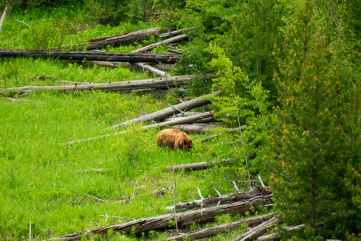
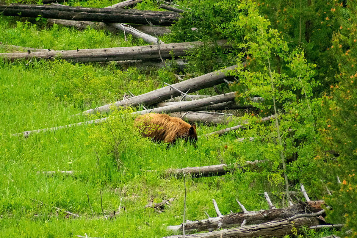
 When we started driving westward, we were headed to Mammoth Hot Springs for lunch, but as often happened, our actual route took a few twists and turns. We took a short turn to see the Petrified Tree, but only circled the parking lot and looked at it through the window. If there had actually been a free parking spot, we might have stopped, but the call of nature and a strong desire to eat lunch kept us moving. On the other hand, a little farther along the road we once again spotted a gathering of cars, trucks, binoculars, and telephoto lenses. This time our stop gave us a good look at a cinnamon colored black bear, completely ignoring the humans, ambling along and grubbing in the grass for who knows what. No doubt it was his/her lunchtime, too.
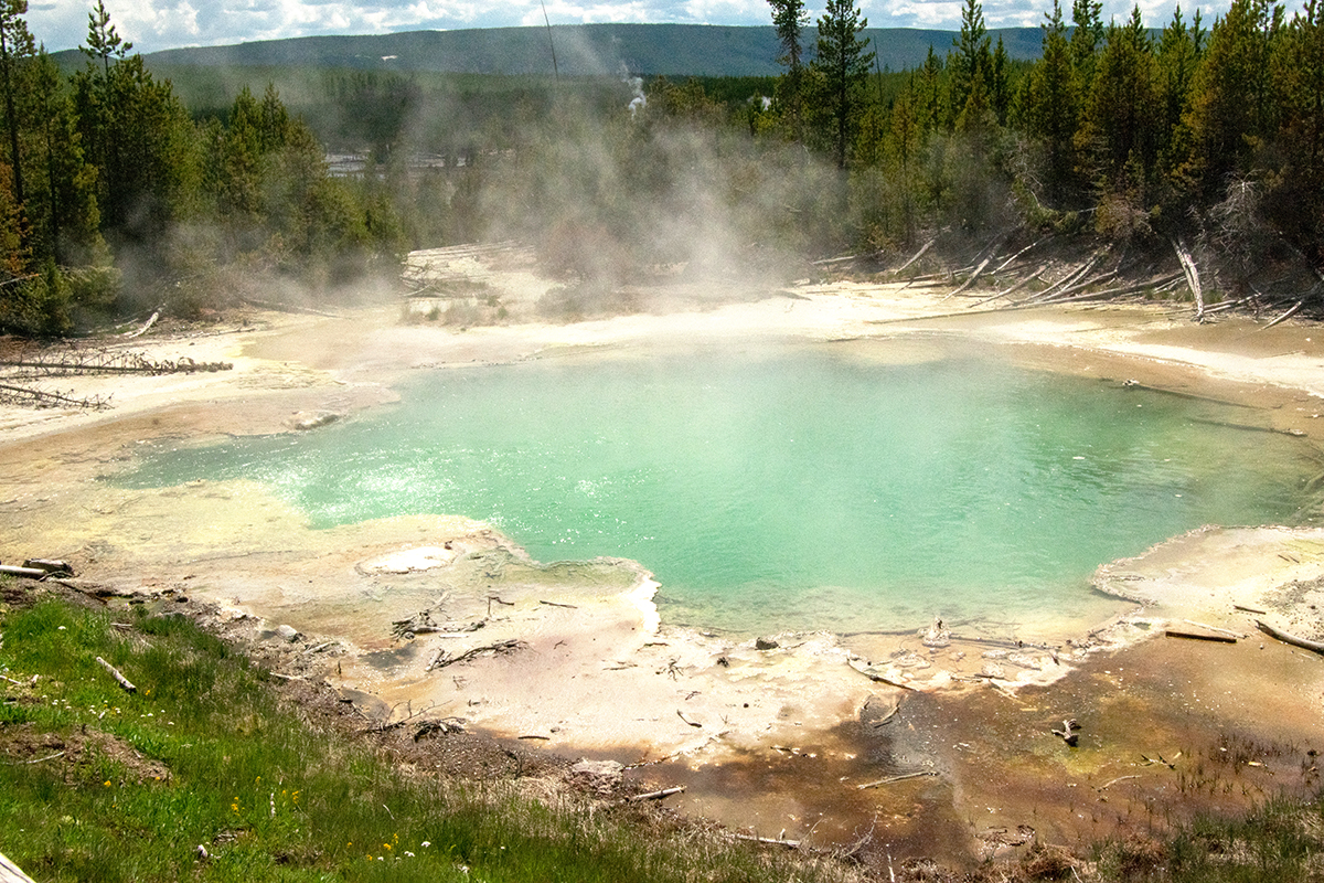
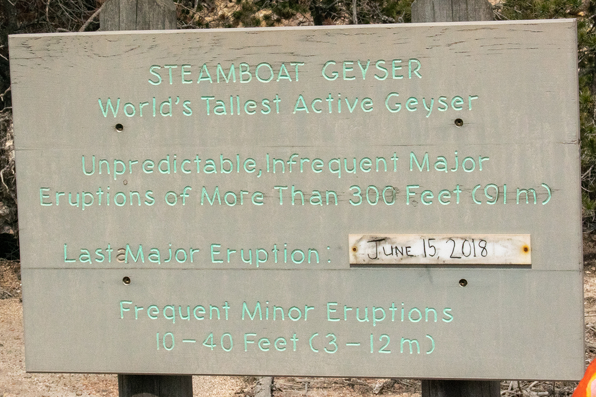
 We did finally make it to lunch, at the restaurant in the lodge at Mammoth Hot Springs, but our frequent stops earlier made it a late lunch. Instead of taking time to see some of the sites there, we decided to drive on and check out some of the geo-thermals closer to our lodge. It’s a good thing we did, because the drive south was a slow one because of rain and construction delays. I’m glad we had time to stop at two places Dan had marked on our map. The first of these stops was at the Norris Geyser Basin, which once again presented us with a parking challenge, one we solved this time. Just like on our stop the day before, we saw smoking ground, hot springs, mud pots, and geysers right next to healthy looking young pines and apparently happy wildlife. It was a little surreal. The boardwalk we followed to get to the Steamboat Geyser went ran through a stand of pines one minute and along one geo-thermal or another the next. We made it to the biggest attraction here, the Steamboat Geyser, but we didn’t get to see one of the major eruptions. The noise of the little eruptions we did see, only 10 or 12 feet tall, was enough for a quick stop, I guess.
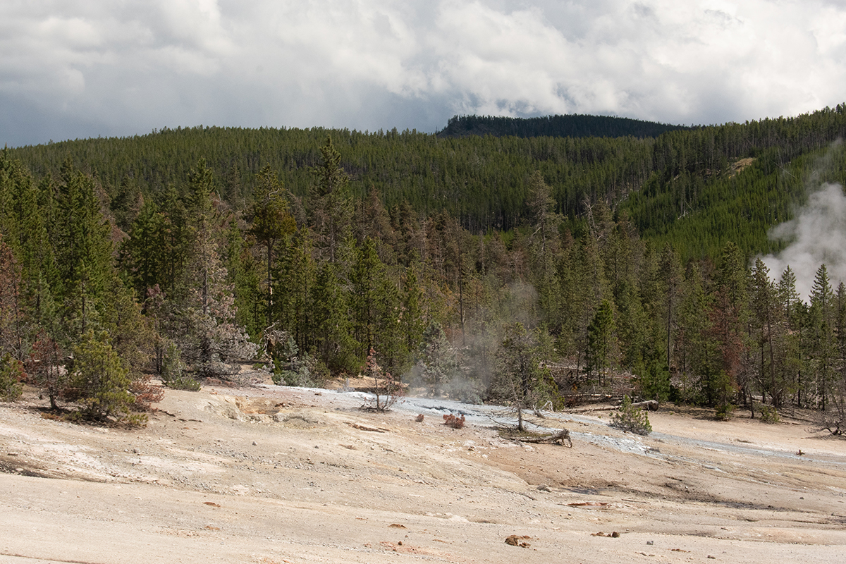
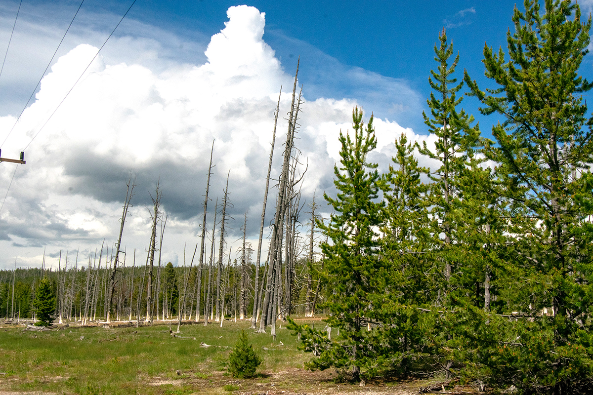 Soon enough we loaded up again and went on to another geo-thermal area: Artists’ Paintpots. (If I were one to quibble about the names given to natural features to convert them into tourist attractions, I’d probably say something here.) This time our walk from the parking lot, though it started out like the last ones as it curved along through some young pines, presented a strong contrast. For one thing, we were sometimes walking along a path, not on a boardwalk that we could expect to keep our feet clear of any sudden breakout of mud or steaming water. For another, this path took us through a spooky-looking partially burned out stand of pines. And the bottom foot or so of the standing trunks were stained white, I suppose from the mineral content of a flood at some point. Or maybe it was just from some snow melt. Flatlanders don’t know about these things.
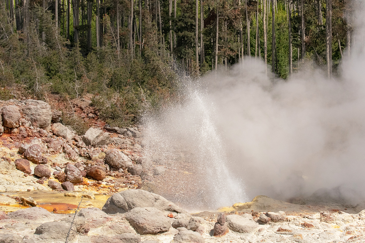
 I was a little disappointed in the actual “paintpots” themselves. I expected to see more color, I guess. I didn’t get to the top of the walkway to look down on them, so perhaps I would have been more impressed if I had made that trek. The area as a whole was wetter than Norris Geyser Basin, though. Really wetter. There were separate pools, springs, and geysers, large and small, and there was a lot of run-off from those things just swirling away. For most of the way there were boardwalks over the worst of the runnels of smelly water, and I think the muddy spot we had to step over on the ground was just rainwater. It makes me more comfortable to think it was, anyway. I’m pretty sure a good bit of the runoff came from this thing: the Blood Geyser. It just continuously erupts, spewing steamy water a few feet in the air, and it’s been documented as doing it for over a century. Maybe that’s what turned the base of those dead pines white. Check the video out below.
After that little excursion, we were pretty much done in for the day. We drove on to the Inn, ignoring several possible stops along the way, and called it a day.