J&J Circle the British Isles
On and Off the Isle of Skye
Monday, July 17
A great day. After breakfast, in the van to the tourist office, on a cold, windy rainy Monday. “Sorry you missed summer–it was two days ago.” We asked about everything on our list, with emphasis on what we could see on a rainy day. Decided not to try the “Old Man of Storr,” but we learned of boat rides to see seals. That sort of structured the day.
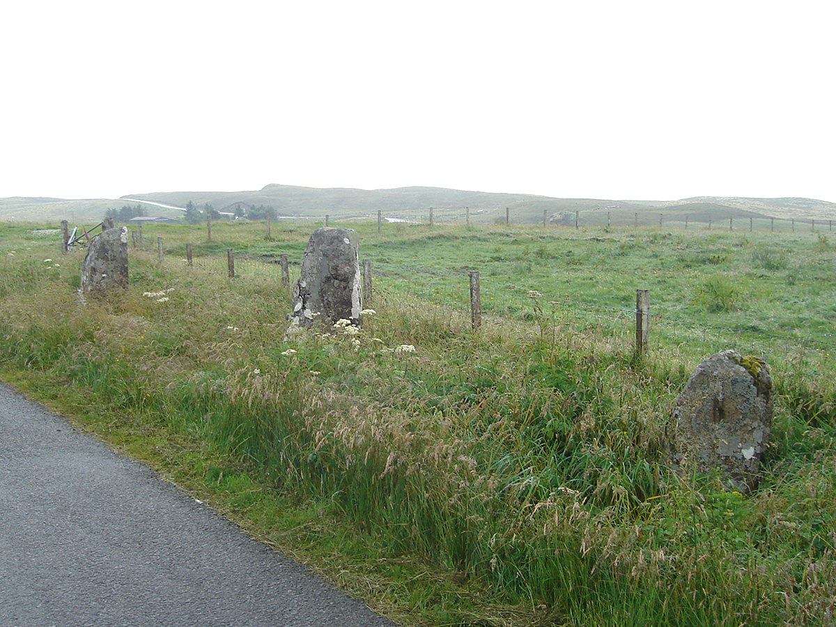
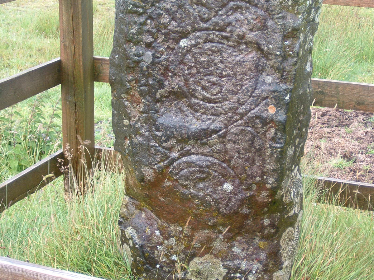
Borve Standing Stones
We left Portree headed northwest and followed the signs to Borve in search of standing stones. Not a town, not a village, just scattered farm houses. The tourist people said we wouldn’t find signs, and they were right! We stumbled across the three big ones quite accidentally, then found the two smaller ones hidden in the tall grass. Right beside the road. No sign, no fence, no protection. Amazing.
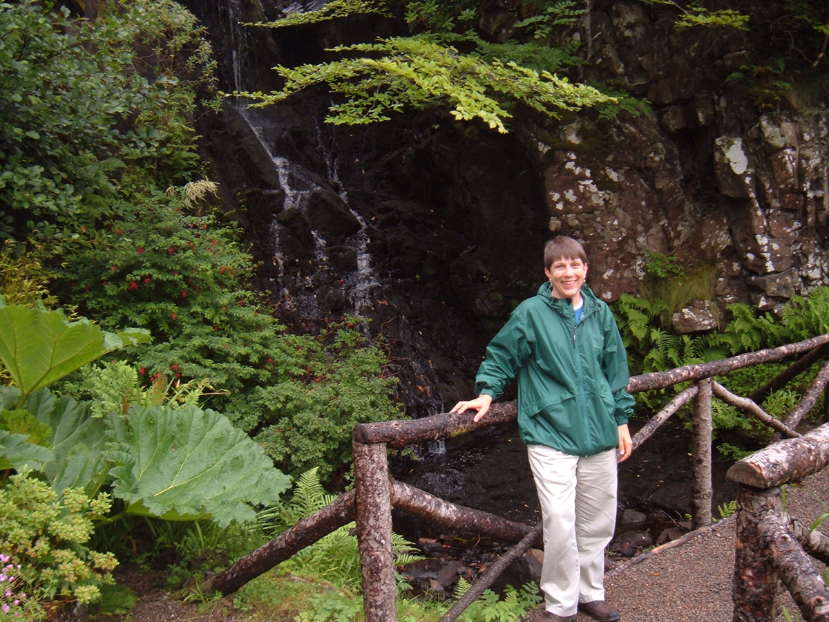
Back in the car and farther along the road, we made a turn to Tote. Windy! Blowing mist! Fierce weather! We jumped out, approached the little fence (at least it gets some protection that way), made a few quick pictures and jumped back in the car. Fast.
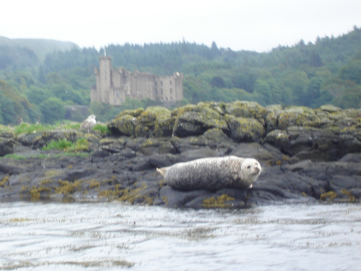
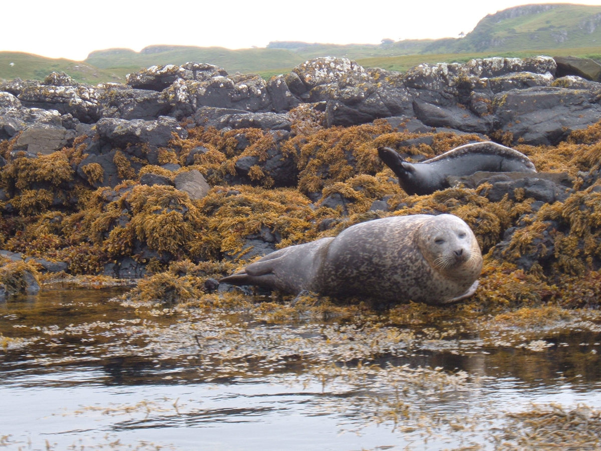
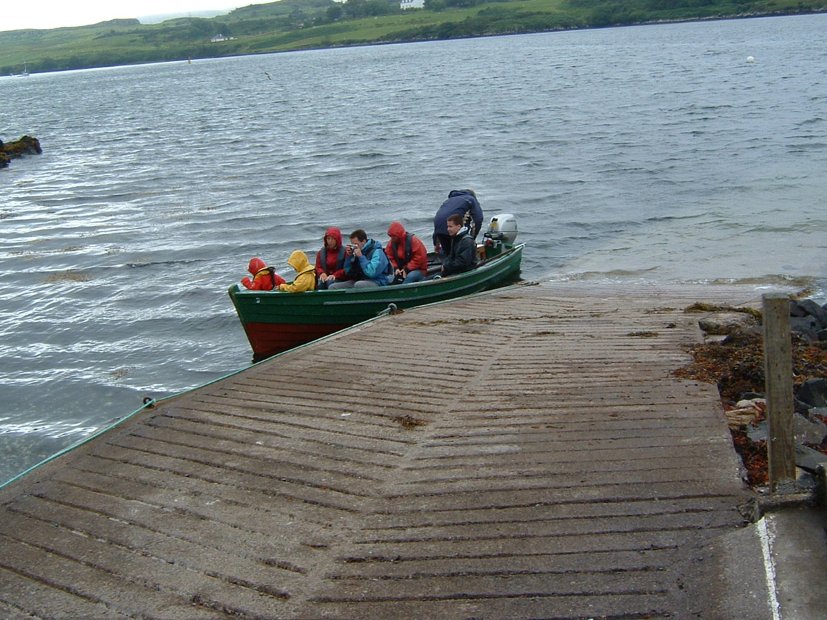
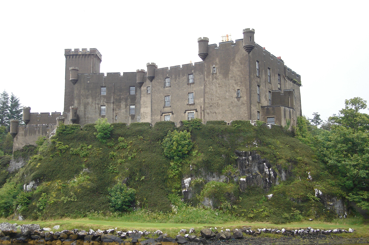
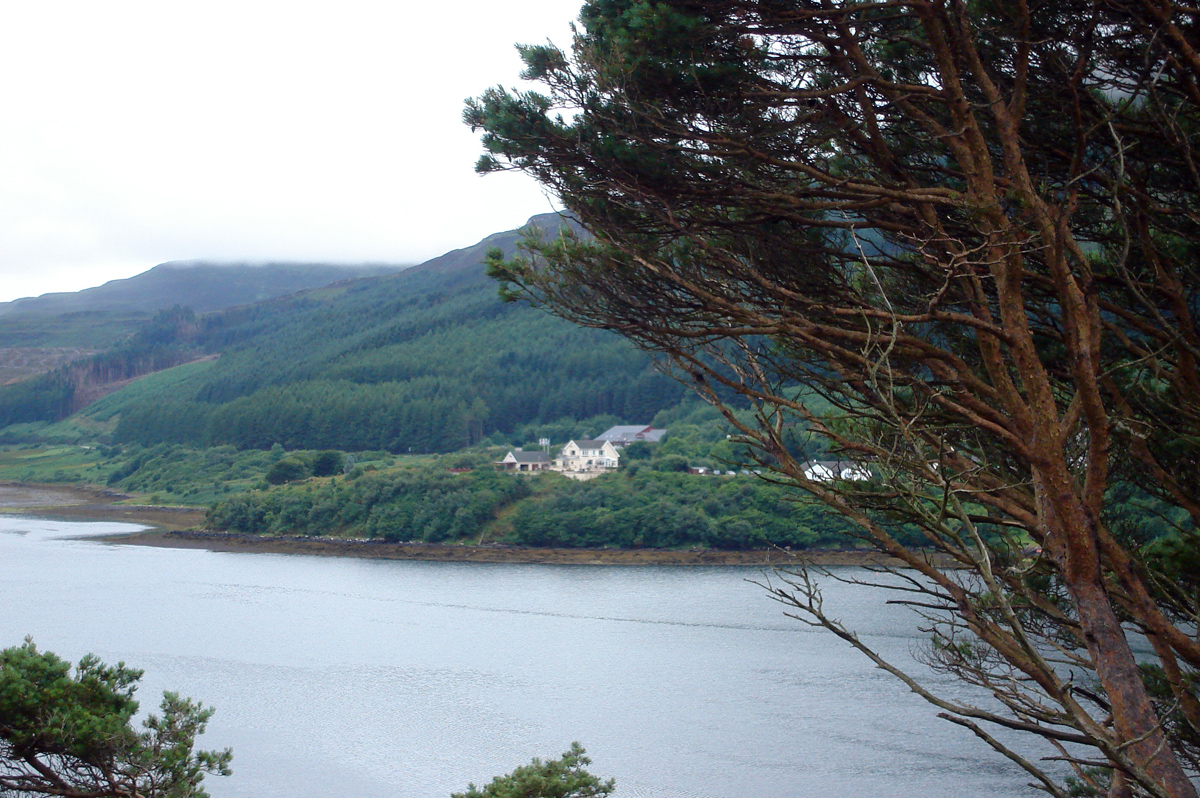
Seal and Dunvegan Castle
We drove through clouds, rain, fog, mist and other gunk up the hills, through the valleys, to Dunvegan. We puttered around a bit, asked that tourist person about the seal boats, committed ourselves to the ride, parked and got tickets. I expected a biggish boat–it was a small “row boat” with an outboard motor! We sat–seven people–on the flat seats, with deep salt water six inches below where my butt was. Cool! The old guy was a great guide. Even went out of his way to let KC get close to some sheep grazing on a vertical rock face, almost. See the pictures! The seal is an ungainly creature out of water. Ugly, in a way. They just flop around. These were harbor seals, to use the North American name. Gray in color, almost white when dry. Pups are black, and they stay in the water a lot. One or two of the photos, and one of the movies show a pus, maybe three or four weeks old. Really neat.
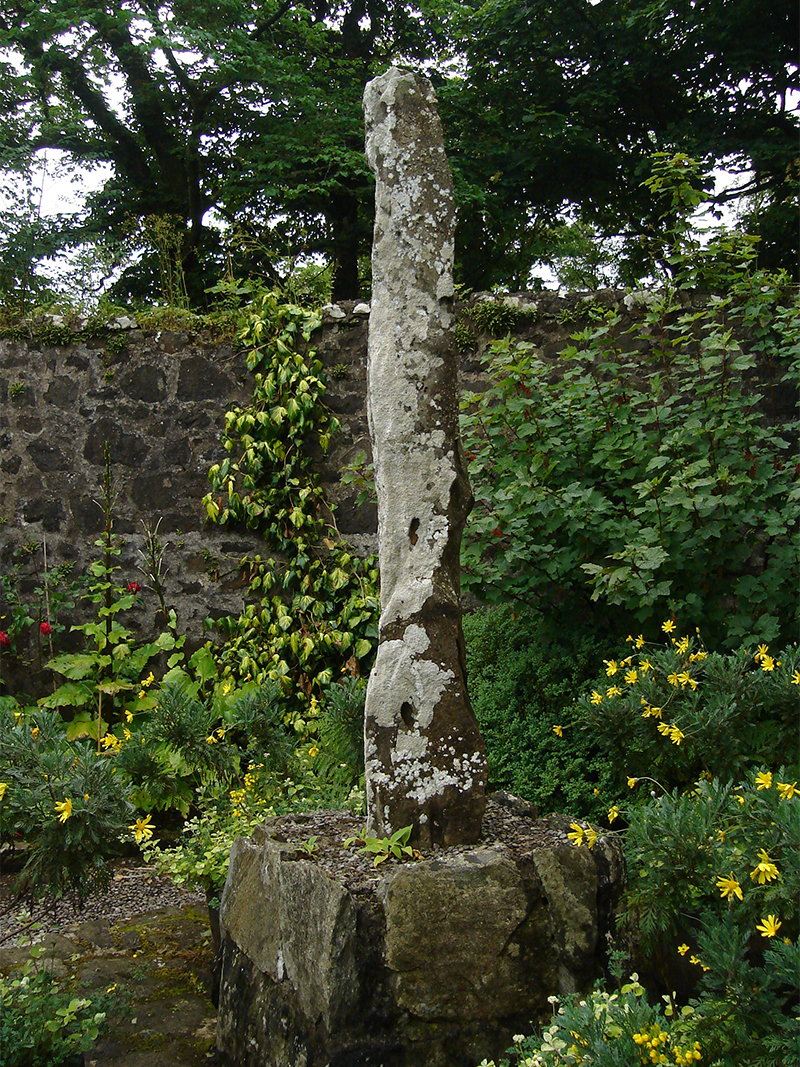
Dunvegan Garden
We walked through the grounds of the Dunvegan Castle and the associated gardens. That took a while. The Grounds were an extensive shade garden, in effect, and the only neat, orderly plantings were in the circle garden and the walled garden. See photos of garden buildings in one corner, and a stone feature modeled on standing stones in another.
When we left we back-tracked some, went through Waternish to the Stein Inn–just about the end of the road–for a 2:00 lunch. Supposedly the oldest Inn in Scotland, and voted Pub of the Year in 2005 and 2006 for the Inverness and Western regions. Good food, and enough atmosphere for any two pubs.
After lunch the real fun began–getting to the Niest peninsula and lighthouse. We drove on a single-lane road, and that wasn’t a problem in itself. But the tops of all the hills were in the clouds–maybe more than the tops. We made many jokes about “Harrrrr”–Val’s word for the impenetrable fog from the north Sea. Up and down hills, around curve after curve, all in thick fog when we were in the upper reaches of those hills. And the country-side was getting rockier by the ‘unit’–a mile in this country. Eventually we hit the small space for parking cars at the end of the road, at the top of a cliff in dense fog.
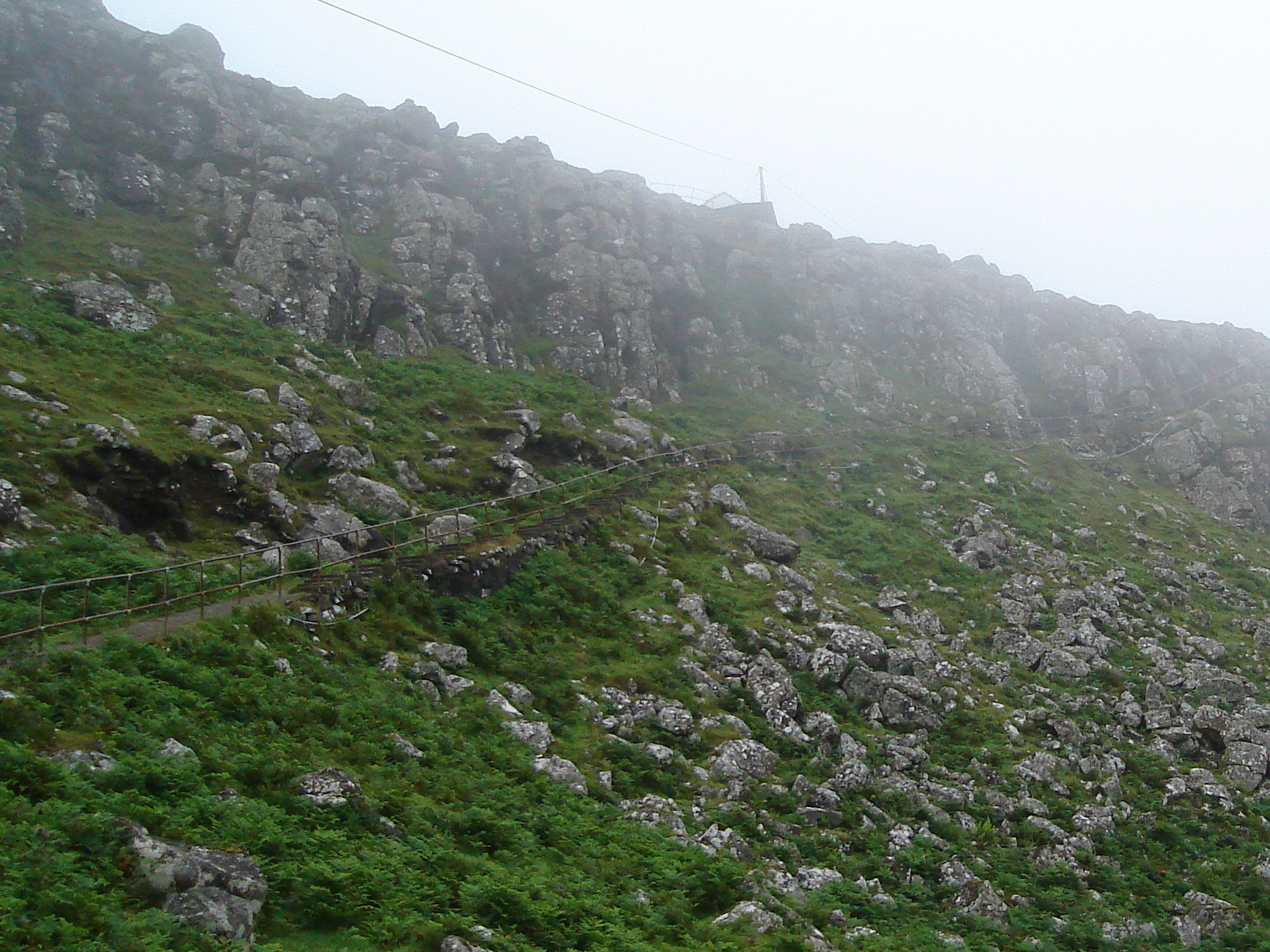
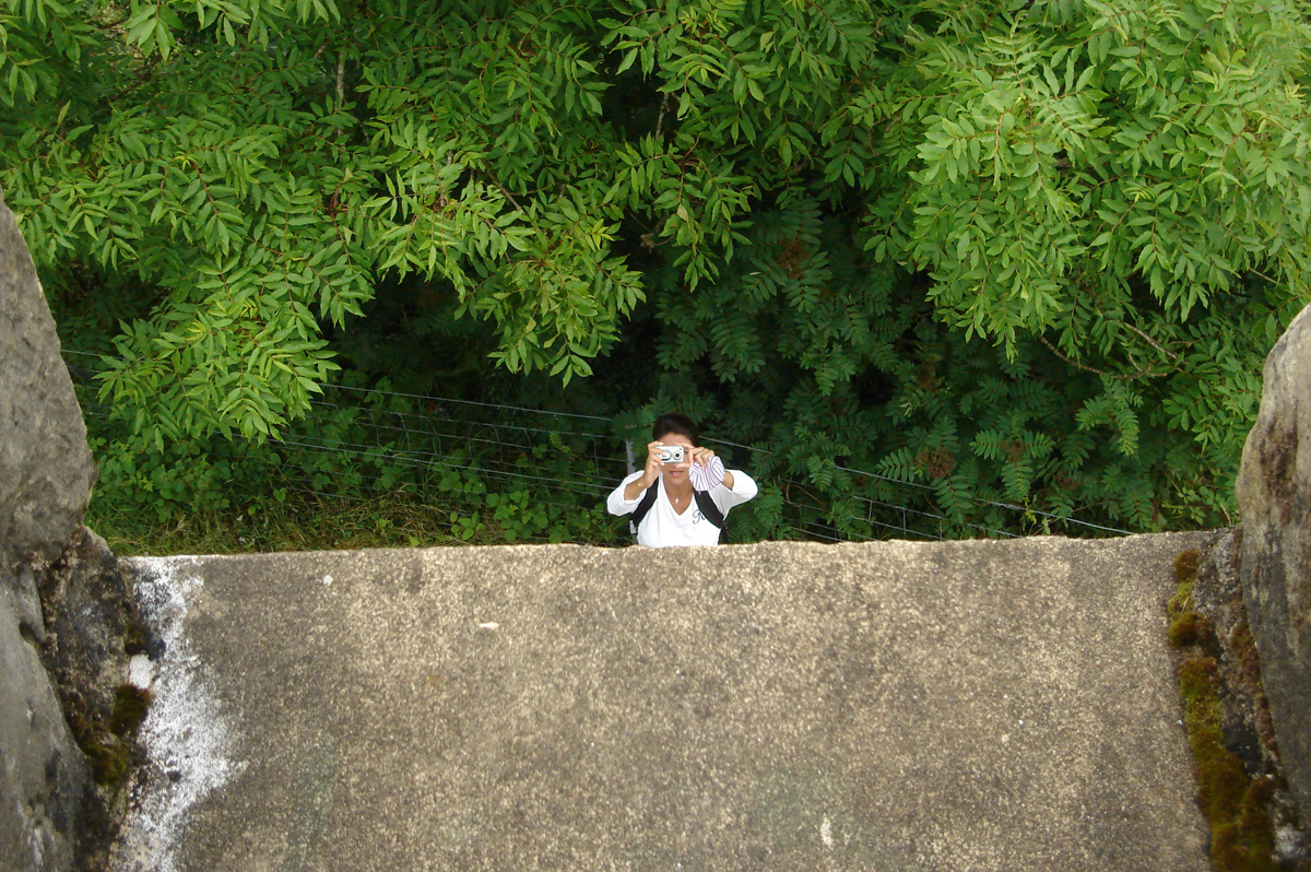
Pathway up and down the gentle side of the cliff
The walk from there to the lighthouse was spooky at first. A staircase fitted diagonally down the cliff; you could look over the rail and see dim white shapes directly below. I though they were white caps, but they were sheep! Sixty or seventy feet below us. Down into the fog-less part, along a cliff up a gentler slope to another peak in the fog. Judy, Mark and Sara turned back, but KC and I pressed on. Down and up again. We stopped short of going up to the building. The inaccessible thing is rented out as self-catering apartments!
I really struggled getting back up the cliff–in spite of the steps–to the car. Panting like a tired dog, and a pulse rate and strength that was scary. All ended well. We stopped at Skye Silver on the way back to Portree. Then we walked to dinner in the town. I collapsed.
Update 2020: In 2006 I hadn’t seen any photographs of the peninsula and the single-track road, or the pathway to the lighthouse, and in the fog we couldn’t really see where the edge of the cliff really was. If I had seen this web site, I might not have driven up there!
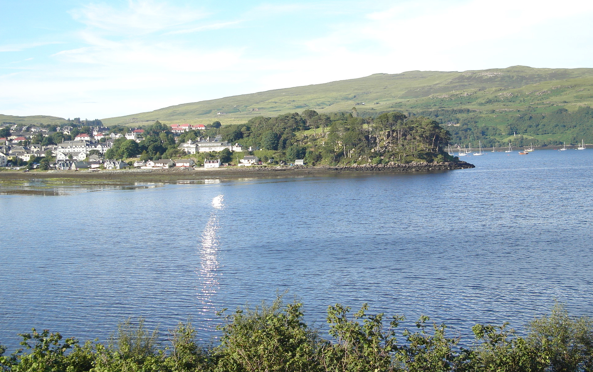
Tuesday, July 18: In and around Portree
After breakfast, we parked in Portree and hit the laundrette, bank, camera store, bakery–all over the town. Shopping, mailing things, checking e-mail, doing laundry. The last stop was at the bakery, where we bought “filled rolls” for the road and headed out on the tourist trail around 12:30.
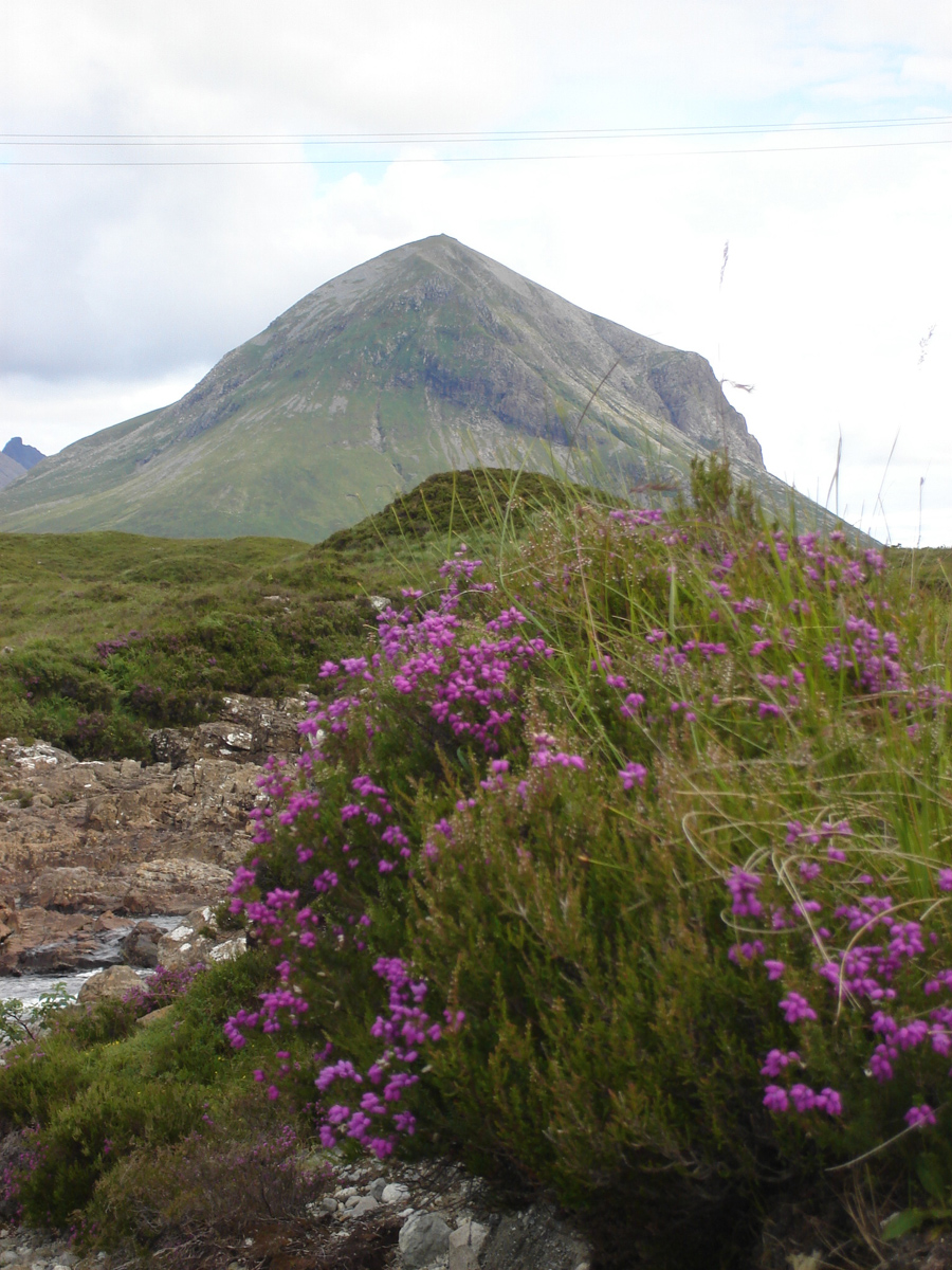
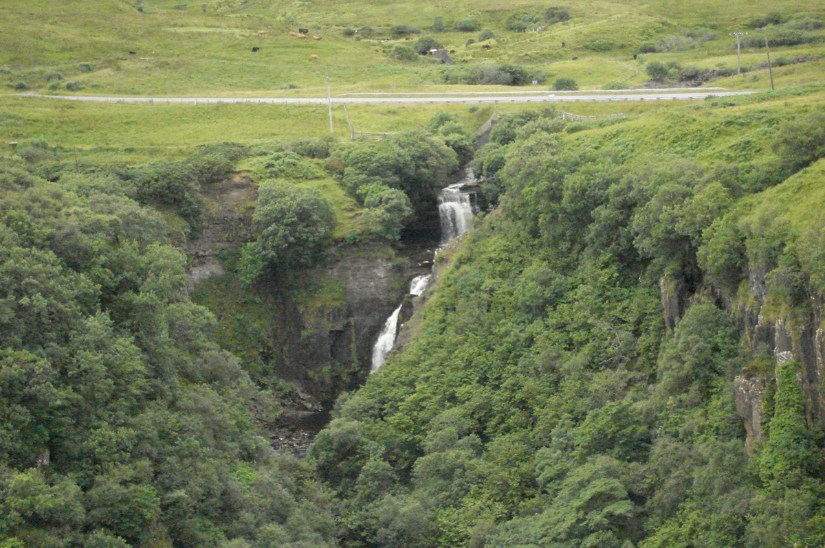
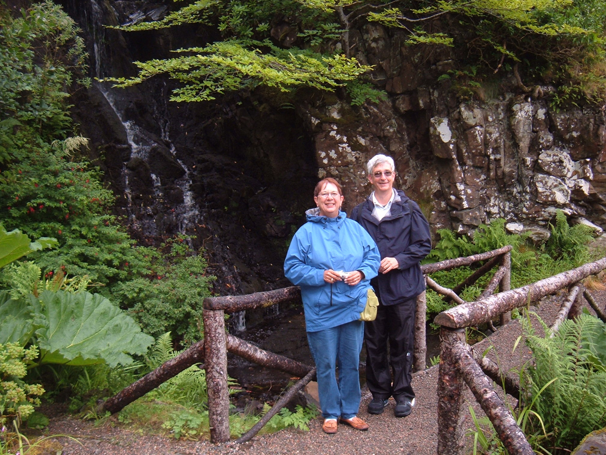
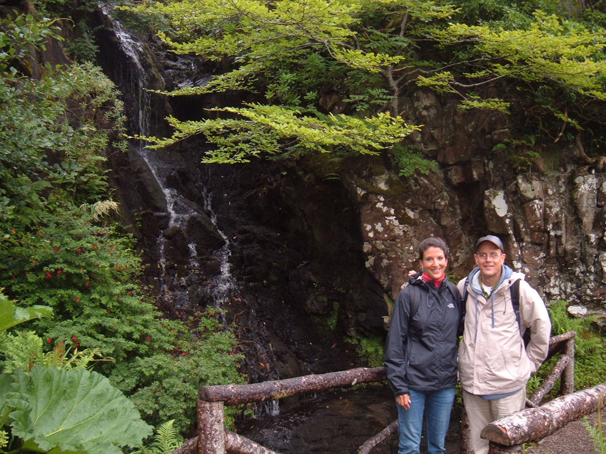
We sped past the parking lot for the Old man of Storr, looking for a farther one that wasn’t there. Stopped at a waterfall that turned out to be Leath falls, not Meath falls. Started back to Portree, double-checked the map and realized our error. Turned around, went past leath to Meath falls, but missed that one. Turned around in Stoffin and finally way the Meath falls and Kilt rock. The McLeod Tables were off in the distance, but we turned our backs on them and headed all the way back to and through Portree to Sligachan, made a right turn, and went to the Talisker Distillery.
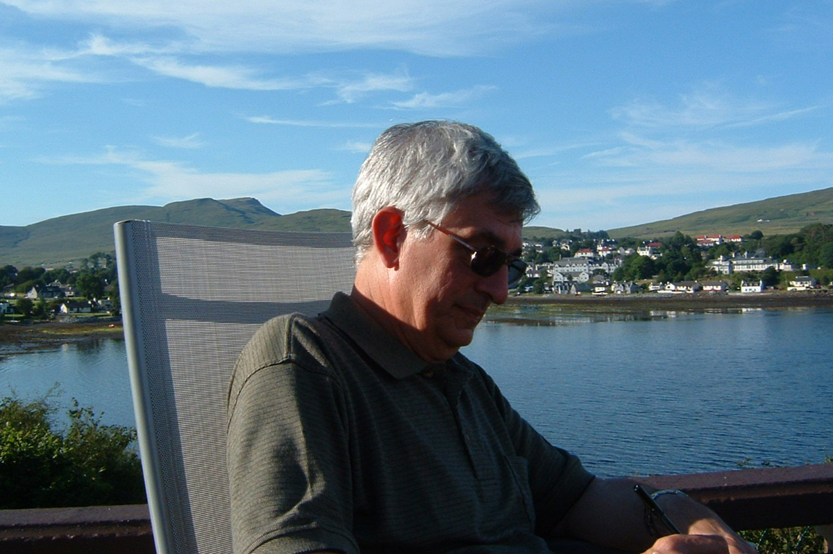
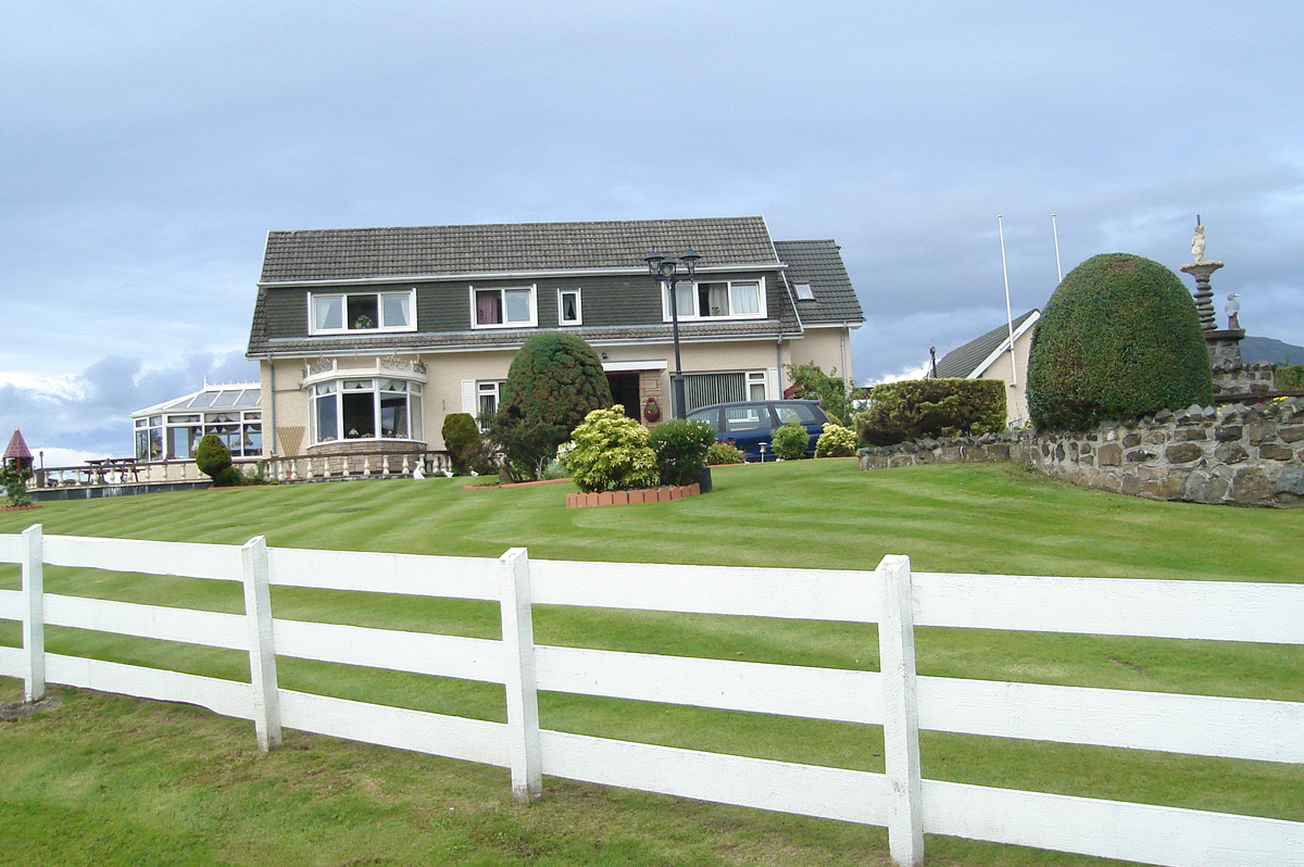
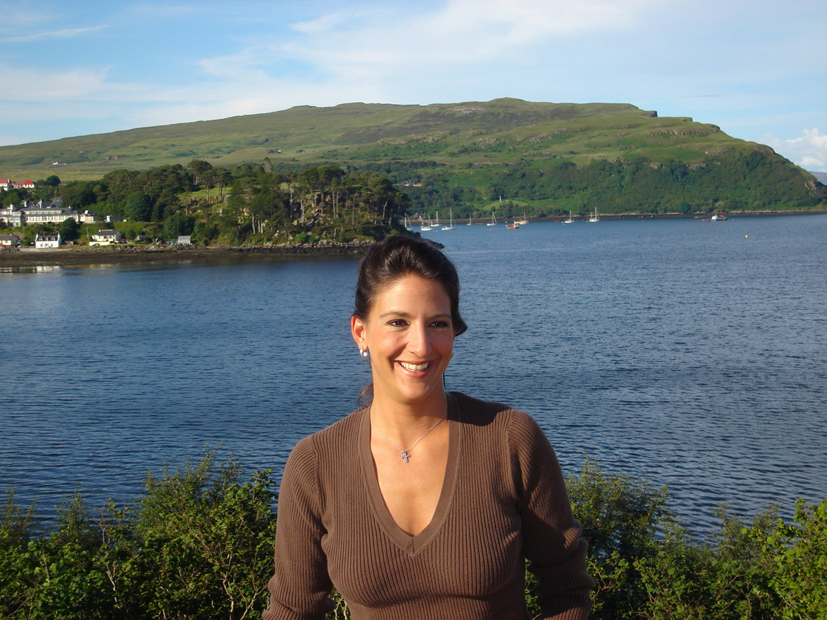
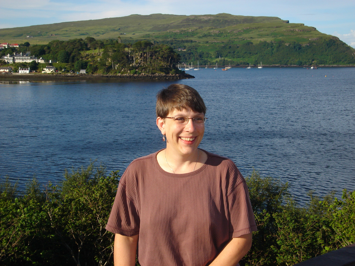
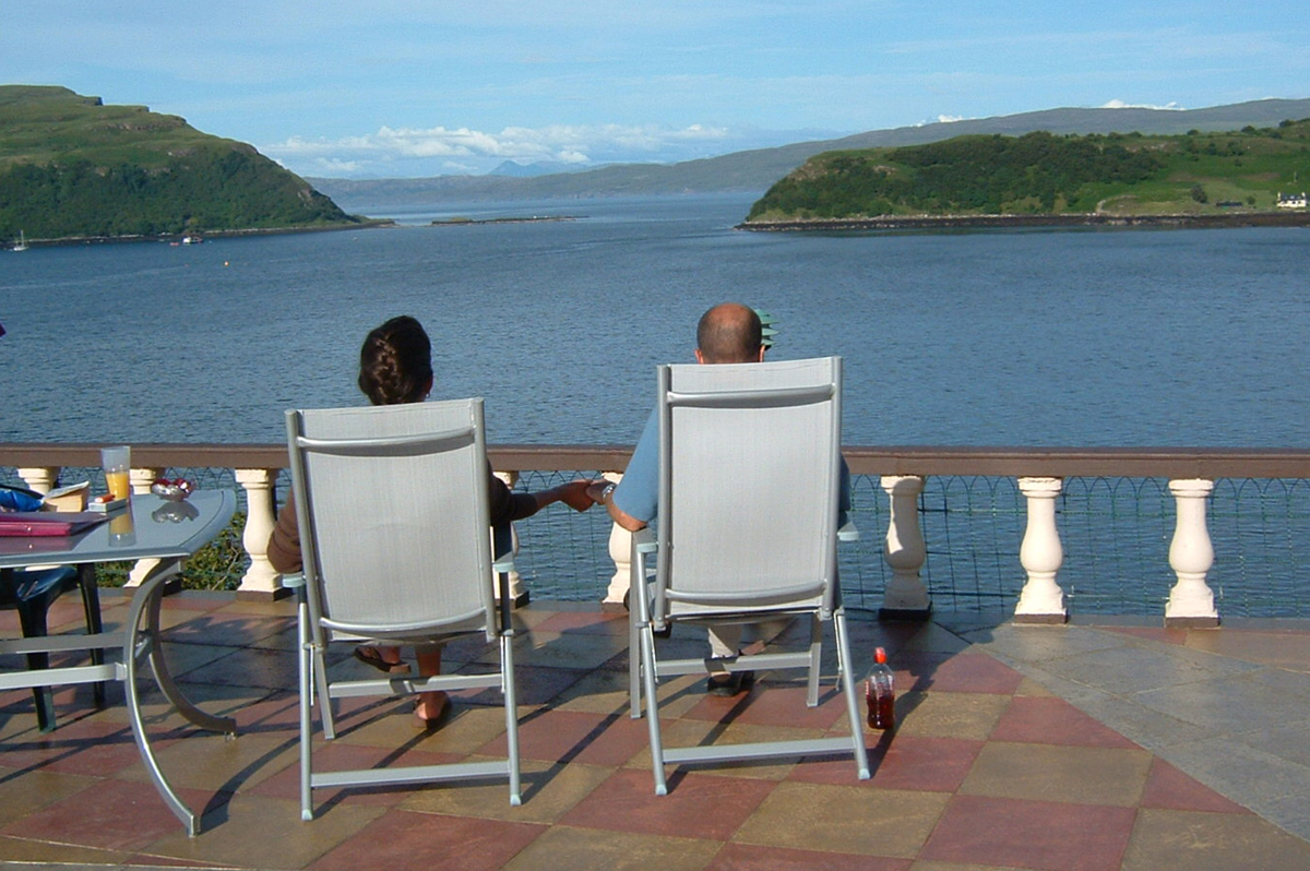
Sara and I did the tour. The others shopped and sipped juice at a pub. We stopped at Sligachan for photos of the Cuilins and a potty break, and returned to Green Acres. Brief break, and a short trip to town, then a wonderful hour on the patio. Beautiful weather, gorgeous light–everything we could ask for.
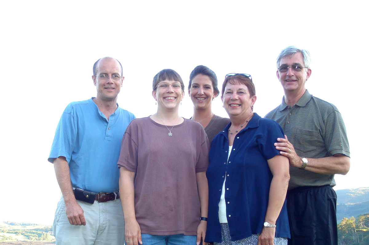
We drove up to the Cuilin Hills Hotel for dinner–very nice. Posh, even. Family photo over-looking the bay. Back to Green Acres. Peace. Beauty.
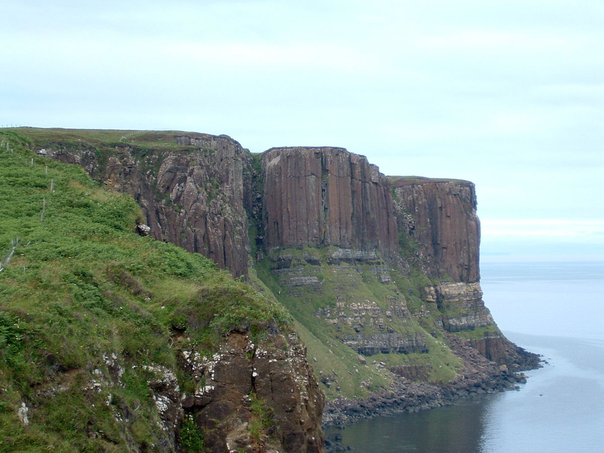
Kilt Rocks
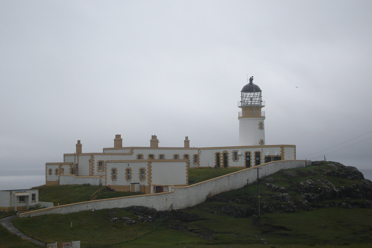
Neist Point Lighthouse
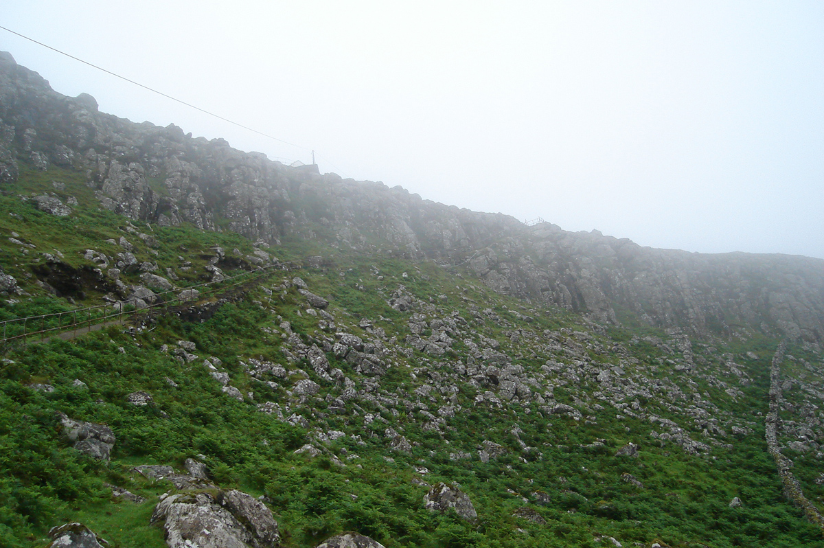
See the Path up that slope?!
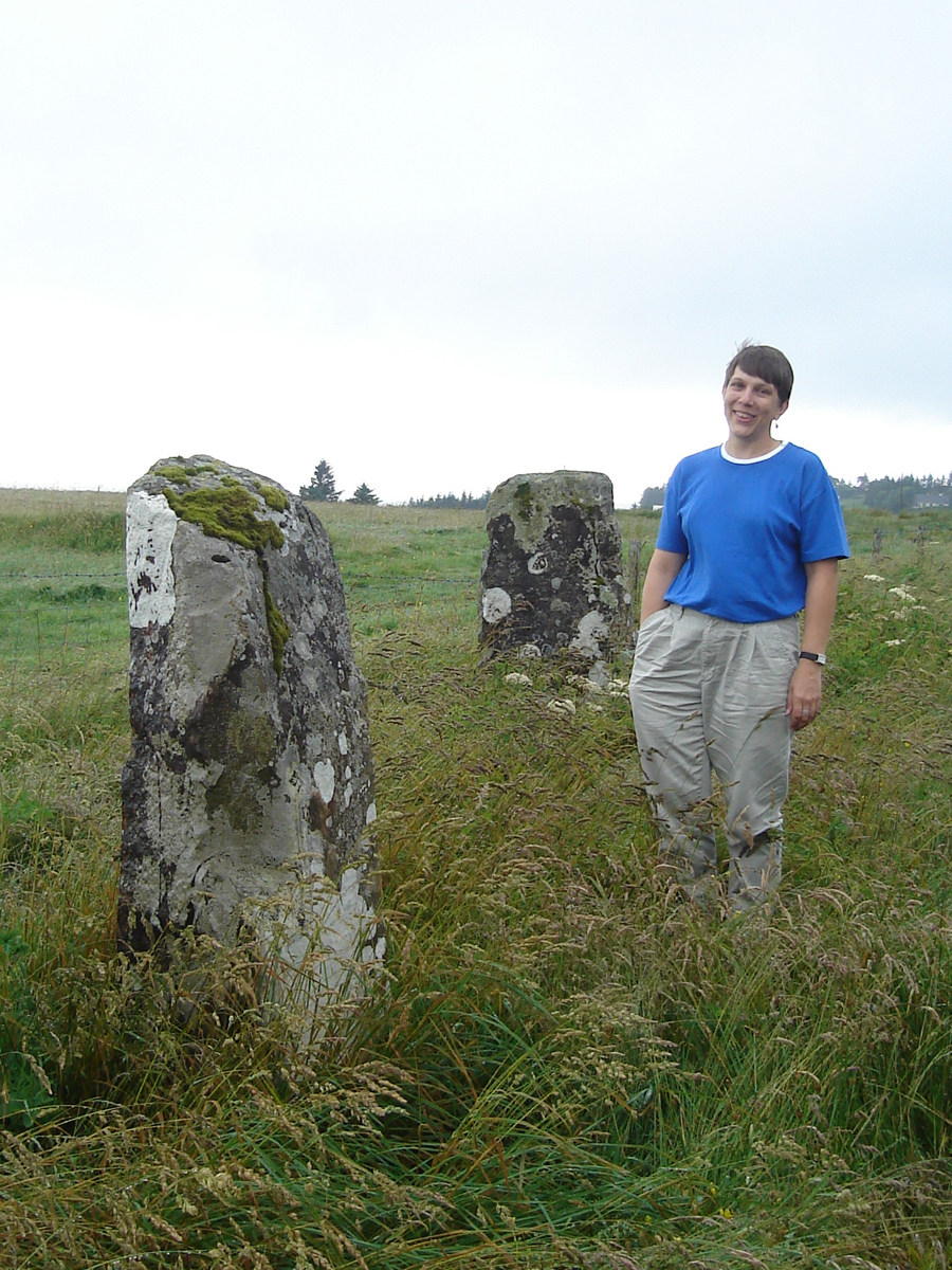
Scottish Stones and Tori
Scottish Road Sign